
Advanced E-Scouting
Hey, you! Yes, you—on the couch, in your Max-7 slippers. Why aren’t you scouting ducks right now? Yes, I know the season’s over. I also know there’s a foot of snow on the ground and you could park a Zamboni on the surface of the pond you hunt for early teal. But in the digital age, there is no such thing as an “off-season.” In fact, at this very moment, the portal to your next great waterfowl adventure could be lying on the table beside you, plugged in to a wall charger.
That’s right, we’re talking e-scouting: how to use the latest tools of online research and digital mapping to take your duck hunting game to the next level. Maybe you’re a brand-new license holder looking for your first waterfowl harvest. Maybe you’re an experienced pro with enough bling on your lanyard to co-star in a 90s hip-hop video. Or, like most of us, perhaps you’re somewhere in between. If so, rejoice: Today’s online resources can help each of us take the next step on our waterfowling journey—if we know how to take advantage of them and the right questions to ask. Here are some to consider.
Step 1: What Region Will I Hunt?
Let’s start big picture. The first step in choosing a spot to hunt is choosing a region to hunt. Lots of factors can come into play in this equation, such as your gas budget, scouting capacity, hunting buddies, and weather considerations. But a great place to begin is by asking, “Which regions in my state or province (or neighboring states and provinces) are most productive for duck and goose hunting?”
Your answer, in all likelihood, is just a few keystrokes away. Most states publish county-by-county harvest statistics on official game department websites, and this macro data can help you zero in on regions to concentrate your scouting. In my home state of Washington, for example, over 50% of our annual waterfowl harvest occurs in just five counties, while the other 34 counties combine to comprise the remainder. Of course, you can find an isolated honey hole anywhere (one of our most consistently productive puddle duck ponds is tucked away in one of these sleeper counties), but prioritizing your scouting in regions that hold thousands of birds during peak migration will give you a head start.
Speaking of veteran waterfowlers, what might a seasoned pro want to do with this macro data? After all, you already know where the birds will be this fall, right? Maybe. As the ancient philosopher Heraclitus would remind you: “There is nothing permanent except change.” You might be surprised when you examine the latest big picture trends to discover that formerly consistent areas of duck and goose production aren’t as reliable and, conversely, you could pinpoint some up-and-coming areas that show promise. A helpful tool to zero in on these is to combine the raw duck harvest statistics with another commonly published statistic: hunter days afield. Pull that pencil from behind your ear and do some quick division to make a “ducks-per-day, per-hunter” chart in your journal, and then find the keys to the truck. Your next favorite mallard hole might be in the county you never thought to scout.
Step 2: Where Can I Hunt?
So let’s say you’ve zeroed in on a new region you want to explore—3.897 ducks per day in County X? You’re salivating! Now how on earth do you decide where to hunt within that region?
Again, your state or provincial game department website should be your first stop. Many agencies offer interactive web-maps that can direct prospective hunters to public and private land access opportunities. The North Dakota Game and Fish Department, for example, offers an online tool called Hunting Atlas that a road-tripping duck chaser could access to plan a trip. Just check the “waterfowl” box on the layers tab and watch amazed as color-coded access opportunities begin to populate the map (green for state waterfowl production areas, yellow for private lands open to public access, red for game department lands, blue for state trust lands…it’s a veritable rainbow of opportunity!). Along these same lines, an off-season email to a state regional waterfowl biologist can also yield directions to a productive duck hunting property, especially if you send it before spring surveys and summer banding projects begin.
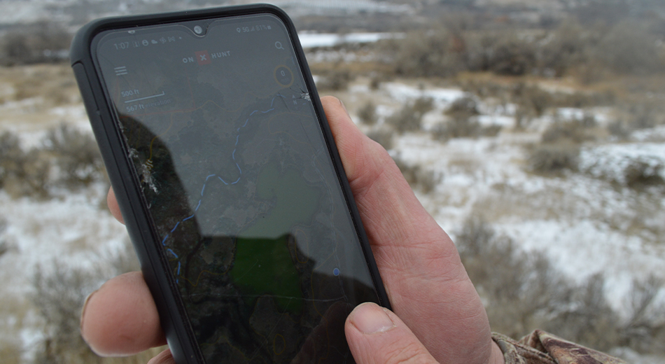
But of course, in the 21st Century, you’d be hard-pressed to find an easier way to identify public duck hunting opportunities than downloading a digital mapping app like OnX or HuntStand.
“Staying legal is one of the biggest concerns for new waterfowlers,” notes Lake Pickle, senior marketing manager and waterfowl section lead for OnX. “That’s the most basic use for an app like this: to find legal, public lands for hunters to access.”
Like other interactive maps, the visual layers on these apps are color-coded and, for certain public lands, tagged with region-specific access rules.
“I grew up hunting a NWR near my home that took years to figure out,” Pickle recalls. “Some zones were no-shooting areas, others open Monday through Wednesday, others weekends only. It could get overwhelming.”
But now, OnX and other apps offer property-specific layers that can help hunters know the rules for exactly where they’re standing. It’s always important to consult official state or refuge regulations, of course, but apps like this give today’s hunter a huge leg up over previous generations when it comes to staying within the law.
Step 3: Where’s the ‘X’?
So let’s zoom in even closer. You’ve identified the region where you want to hunt. And you’ve identified a property you want to hunt. How can you figure out where to hunt within that property? The old answer was boot leather and binoculars. And those tools still have their place. But today, you can save yourself hours and blisters by doing your phone homework ahead of time.
Consider the three basic needs of ducks: water, food, and security. If you find any one of these factors, let alone all three in the same place, there’s a good chance you’ll also find ducks. So start with:
Water. Here is where I direct first-time waterfowlers to begin. Use your mapping app to mark any ponds, creeks, lake points, or impoundments – then lace up your boots and look for ducks. But that’s just a starting point. As seasoned waterfowlers know, not all water is created equal. Some bodies of water are shallow enough to wade in gardening boots; others will require a boat. Some ponds will ice over with the first frost; others will stay open into the single digits or even below zero. So how can you tell the difference?
Color is one factor to note. On lake edges, in particular, a shallow shelf can appear as a lighter blue in aerial imagery, sometimes even shading into a tan/brown. These areas will freeze earlier than deeper water but also offer the walk-in hunter an opportunity to wade into big water and set a spread without a boat. Color can be your tip-off to warm water springs as well, which in our region tend to appear as an aquamarine on satellite photos. White water or foam on satellite imagery can be an indicator of moving water, which can also offer hunters the opportunity to toss dekes after freeze-up. Mark such features on your mapping app and then confirm when the thermometer drops. You may have just found your late-season Shangri-La.
For veteran waterfowlers, one of the most intriguing new mapping features could be developments in real-time measurements of water surface extent. Pickle explains: “OnX now offers the ability for members to see recent imagery that’s updated every two weeks. This imagery will be lower resolution than our base maps, but on a macro scale, you’ll be able to easily see which areas have water and which areas don’t.” Such intel is gold for the public land hunter. Just last November, while hunting a walk-in area in which water levels fluctuate unpredictably based on irrigation demand, I flushed 200 mallards from a knee-deep puddle in a cottonwood grove. Just a week earlier, the same puddle had held nothing but tumbleweeds and dust. And a week after it was flooded with rainwater and mallards? Dry again. Now you can check the water levels on your app before hiking in, a game-changer for public walk-in hunters.
“Private land hunters will want to use this tool as well,” Pickle points out. “I’m a member of a duck club in Mississippi where the water levels will change based on the river. It’s super helpful to just pull out my phone and say, ‘Hey look. The C-13 impoundment is flooded.’ And then go see if the ducks are there.”
Don’t overthink it. Find the water, find the ducks.
Food. Many game department maps will mark habitat plantings or wildlife food plots on their web-maps for prospective hunters. Such a map helped me discover a plot of flooded buckwheat two miles deep in a state wildlife area that is crawling with mallards and greenwing teal before freeze-up. OnX and HuntStand maps, likewise, now offer crop layers that are updated regularly to provide hunters with the latest data on nearby agricultural plantings. This intel would have saved my buddy and me a busted hunt several years ago when we backpacked decoys deep into a BLM creek that bordered the harvested cornfield where we’d stacked the ducks the year before…only to discover the field was now planted with timothy hay. We saw more mule deer than mallards that day. Let your phone lead you to the feed.
Security. Ducks and geese, like all wildlife, appreciate their privacy. So the goal of scroll-scouting is to discover those hidden pockets (sanctuary areas) where ducks can loaf undisturbed. Satellite imagery is a game changer for this task. Many prime loafing areas for waterfowl are invisible to the boots-n-binos scouter due to tree screens and emergent vegetation. But with aerial photos, such pockets pop from a sea of reeds like a blueberry on toast. Mark them, figure out a way to access them, and then keep your lips shut. Sanctuary areas only work if hunting pressure is limited. These are not the spots you want to share with all your hunting buddies but rather with a small circle of trusted friends who will give the ducks an opportunity to rest and re-discover the sanctuary between hunts.
Bonus: Duck Blinds. This one is a bit of a cheat-code. On many public lands, the game department or local conservation groups (including Delta) have constructed permanent blinds in historically productive hunting locations. These blinds are an excellent gateway for new hunters because they’ve removed the guess work regarding “Where should I set up?” and provide a hide to which the birds are already conditioned. Back in my high school days (when the Spice Girls were charting! And Pluto was still a planet!), the only way to find these blinds was to pry the info from a loose-lipped old timer at the gas station or stumble upon one while jump shooting. But now, with careful pinch-and-zoom scouring, many of these blinds will become visible right there on your mapping app. If you see them, mark them, and then visit this summer to confirm.
Step 4: What Are My Access Points?
It’s one thing to identify a promising location—it’s another to actually get there. Especially when you consider hauling decoys, blinds, watercraft, or anything else you might need to effectively attract and retrieve ducks. Here is where digital mapping apps can be your best friend, once again. Since I’m a decoy cart guy—a refurbished jogging stroller I bought on Craigslist and tricked out with mountain bike tires—the first thing I look for after marking a new honey hole on my phone is the nearest dirt road, usually indicated by a dotted line on the app. While many of these are overgrown (due to the prohibition of motorized access), the level grade and absence of boulders on these abandoned two-tracks make pushing a cart to the pond much easier. If you’re a boat guy, your mapping app can help you identify the closest launching point or maybe even a channel or stream that offers access you hadn’t considered.
Your mapping app can also enhance your safety when precision navigation is required. Pickle recalls hunting timber for mallards in Mississippi’s Delta National Forest during a seasonal flood.
“The only way to keep the boat from running aground was to stay in the center of the channel,” he said. “But since the timber was flooded, everything looked the same. No way to tell the stream channel from the forest floor.”
But fortunately, Pickle and his friend had already marked and saved a route on their mapping app from a prior scouting trip.
“We just followed the red line and got to our hunting spot safe and dry,” he said.
This feature can also be a lifesaver for hunters in saltwater areas where navigable channels disappear with the rising tide.
“It used to be that the guys could steer a boat through the timber in the dark were the dudes who really knew the woods,” Pickle explained. “Now anyone with a mapping app can boat safely if they know how to save their track.”
Step 5: What’s Old School Scouting Say?
Yes, digital mapping tools are better than ever. And yes, advances in AI technology and user-friendly interfaces promise even better tools in the future. But you know what will never change? The stuff you can only learn from time in the marsh. Take the two baby boomers I joined for a trip on the Columbia River last year. Two mornings of public land hunting. Two afternoons of scouting. Predawn launch and night navigation on a busy river. Site selection and blind building each day. Full limits of divers on Day 1. Limits of mallards on Day 2. And not once did I spot either of these guys using their phone.
So do your digital homework now. And then let that homework propel you from the couch to the field. That way, when it’s time to load up this fall, you can keep your heart in the moment and your phone in your pack—right where each belongs.
Field editor Nate Corley is an old soul who appreciates new tech in Tacoma, Washington.